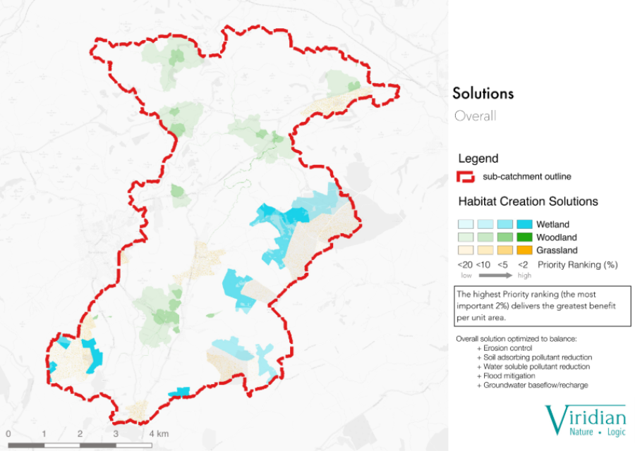

HydroloGIS identifies, ranks and prioritises the best solutions to water-related problems across urban and/or rural landscapes. It identifies the most effective actions to take in the most efficient locations, as well as ranking all alternative options for how well they will reduce local problems.
Full description
Viridian is a highly technical micro-company specialising in the advanced modelling, design and quantification of Nature-based Solutions. We have developed HydroloGIS: a truly unique method for identifying the most effective, natural solutions to a host of water problems - such as flooding, drought or river pollution - then ranking all alternative option for how much impact they will have on local problems. It blends scientific rigour with commercial pragmatism during the advanced, mathematical modelling of ecosystem services.
To this we integrate a whole spectrum of more standard benefits, such as carbon sequestration and biodiversity, so that stakeholders have all the technical advice they need to decide on the best course of action in their community or region – all while meeting project objectives.
This human-centric, participatory design helps stakeholders 'own' solutions, so we rapidly build consensus and make the whole process quick, inexpensive and successful. The benefit/cost ration of using HydroloGIS can be well over 50, since it reduces the cost of achieving projects whilst improving their outcomes.
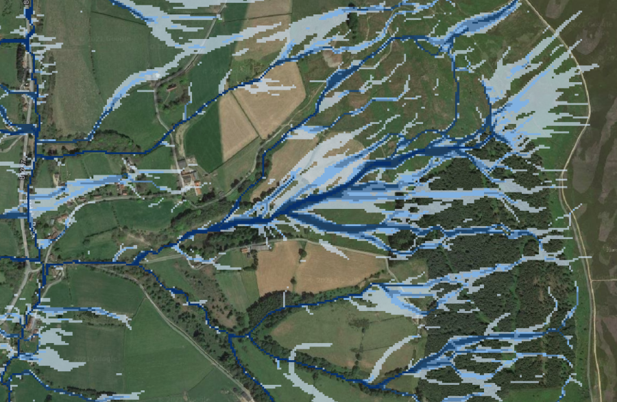
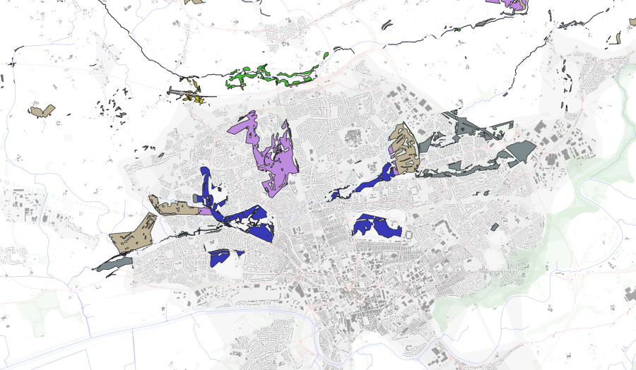
HydroloGIS operates at resolutions from 0.5m to 30m across areas ranging from single fields to entire drainage basins. The results can be used to solve surface water problems, improve groundwater recharge, protect sewers and other infrastructure, and offer many other benefits to a range of beneficiaries.
The delivery of multiple ecosystem services by each intervention helps gain support and funding for projects, including through commercial trading of benefits. The system is robust to data paucity, errors and omissions, so can be applied globally for objectives such as the Action for Water Adaptation and Resilience (AWARE) initiative from COP27.
To this we integrate a whole spectrum of more standard benefits, such as carbon sequestration and biodiversity, so that stakeholders have all the technical advice they need to decide on the best course of action in their community or region – all while meeting project objectives.
This human-centric, participatory design helps stakeholders 'own' solutions, so we rapidly build consensus and make the whole process quick, inexpensive and successful. The benefit/cost ration of using HydroloGIS can be well over 50, since it reduces the cost of achieving projects whilst improving their outcomes.
HydroloGIS operates at resolutions from 0.5m to 30m across areas ranging from single fields to entire drainage basins. The results can be used to solve surface water problems, improve groundwater recharge, protect sewers and other infrastructure, and offer many other benefits to a range of beneficiaries.
The delivery of multiple ecosystem services by each intervention helps gain support and funding for projects, including through commercial trading of benefits. The system is robust to data paucity, errors and omissions, so can be applied globally for objectives such as the Action for Water Adaptation and Resilience (AWARE) initiative from COP27.
Value proposition
The HydroloGIS system can be phased to reduce costs at each stage. For instance, basic prioritisation modelling could be completed for as little as £1/sqkm (30m resolution), then stakeholder consultations undertaken to agree the final list of NbS to install, which can be designed in detail and their cost/benefits calculated.
The cost of our modelling is usually repaid rapidly during stakeholder consultations, as the HydroloGIS outputs are easy to understand and make this process both rapid and effective. It empowers rights holders and engenders trust. HydroloGIS also ensures that the right NbS are put in the right locations, so that projects are a success and their overall ROI is maximised.
The benefit to cost ration of employing the HydroloGIS system over standard approaches can be in excess of 50:1.
Payment conditions
Project specific and flexible
Product pricing
0.00
Implementation time
10 Days
Brochure or other document